Mansfield Recreation Reserve
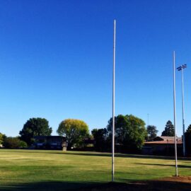
A sporting hub and community meeting place, the Mansfield Recreation Reserve lies at the heart of Mansfield in more ways than one. Visit on a Saturday afternoon in winter and you will experience the passion a country town has for its local football and netball teams, just don’t forget your hat and scarf. The reserve…
Read MoreMansfield Skate Park
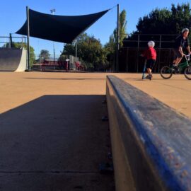
Little kids and bigger kids can test their skills in the Mansfield Skate Park, also known as Rampage. This concrete skate park has multiple features including a street course consisting of roll-ins, quarter pipes, ledges, a metal non-vert half-pipe, plus curved and straight rails. Some sections of the skate park are shaded. Adjacent to the…
Read MoreMansfield Mullum Wetlands
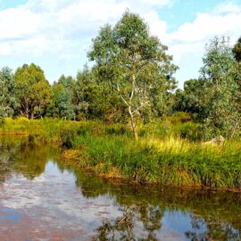
The Mansfield Wetlands provide a habitat for native fauna and are a beautiful and accessible example of a living wetlands ecosystem. The Great Victorian Rail Trail passes through the Mansfield Mullum Wetlands. Walk or cycle along the trail or do the circuit. A full circuit of the Mansfield Wetlands is approximately one and a half…
Read MoreMansfield Station
The former Mansfield Railway Station buildings are well preserved and are home to the Mansfield Historical Society. Adjacent to the station precinct is the Mansfield Visitor Information Centre. The station is of a traditional timber design, and features many original fixtures including pressed metal interior walls, original doors and timber panels and a full length…
Read MoreMansfield Botanic Park
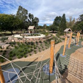
Perfect for a sunny afternoon in town, the Mansfield Botanic Park is open at all times and offers barbecue facilities, picnic shelters and tables, a fitness station, an adventure playground for kids of all ages and toilets. Bordered by Ford’s Creek the gardens are a beautiful mix of native and introduced species. A popular location…
Read MoreMount Samaria State Park
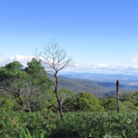
Set in tall, shady eucalypt forest, Mount Samaria State Park offers a cool and quiet retreat for beautiful walks, camping and picnicking. The Mount Samaria range incorporates a variety of scenery with spectacular vistas over the Victorian Alps, granite outcrops, high waterfalls and historic remains. Explore the park by foot, mountain bike or scenic drive…
Read MoreBluff Hut
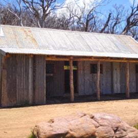
Located in the Alpine National Park, Bluff Hut is the third highest hut in Australia. The original hut, built in the 1950’s, was burnt down in the 2007 fires and has since been rebuilt. Bluff Hut offers basic camping for car-based campers and hikers. From the hut it is a short walk to the Bluff,…
Read MoreFry’s Hut
Master Bushman, Fred Fry, built his riverside high country home in the late 1930s. Using split timber and his own personal style of workmanship he erected many huts in the region including Jamieson Hut, Ritchie’s Hut, Gardiner’s Hut and Noonan’s. Fred lived a solitary existence for many years in the Howqua Hills area, prospecting and…
Read MoreRitchie’s Hut
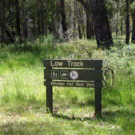
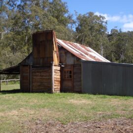
Nestled amongst the mountains and on the banks of the Howqua River, you will find Ritchie’s Hut. Originally built by local craftsman Fred Fry, the hut was a genuine heritage slab construction, built as a fishing hut for the Ritchie family of Mansfield. The construction of the new hut, located on the same site as…
Read More